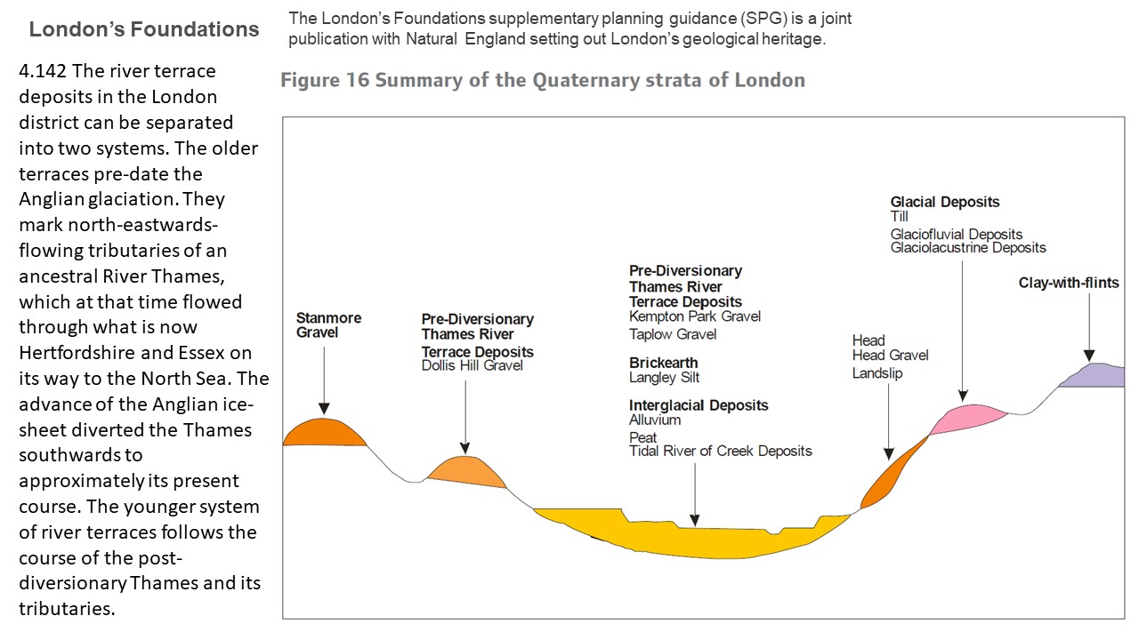
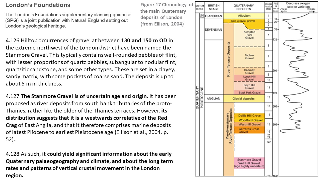
Stanmore Gravel Project
Across this area to the northwest of London where there are hills, we find quite distinctive gravel beds capping the higher ground. The gravel is unusual because it is made up of mostly rounded pebbles in a sandy-clay matrix. The majority of other gravels in London have been broken down by rivers into more angular pieces.
Across this area to the northwest of London where there are hills, we find quite distinctive gravel beds capping the higher ground. The gravel is unusual because it is made up of mostly rounded pebbles in a sandy-clay matrix. The majority of other gravels in London have been broken down by rivers into more angular pieces.
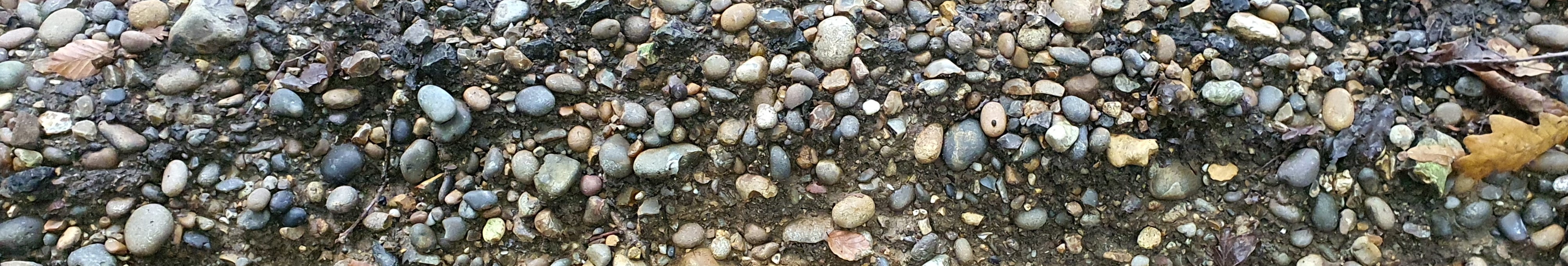
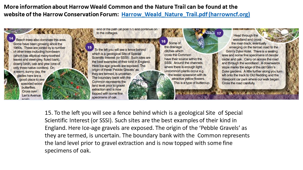
Our local "Pebble Gravel" gives its name to the Stanmore Gravel Formation for which Harrow Weald Common SSSI is the type locality.
At HHGS we’ve been looking into the published data linking the gravels to an ancient tributary of the River Thames, and we invited Dr Peter Allen to talk about this in July 2022. Peter set us a challenge - to carry out some research into the origins of the Stanmore Gravel at our local SSSI in order to add to what is currently known about it. This was the start of the Stanmore Gravel Project. Prof David Bridgland (Durham University) and Dr Phil Collins (Brunel University) agreed to guide us, and we set up a project which anyone with an interest in the topic could join.
The aim of this research is to update knowledge of the geological SSSI at Harrow Weald Common. The methods of testing and any results we achieve will be made available on this website. If they are considered of value to science we would publish a paper in the Proceedings of the Geologists Association (PGA).
Citizen Science
This project gives us the opportunity to advance public appreciation of geology by observation, discussion, field studies, research, illustrated talks and exhibitions. Most of the participants are Citizen Scientists: enthusiasts who wish to understand geology better. The Stanmore Gravel Project will record the steps taken to conduct a piece of locally relevant research. Look out for us on social media #peoplelovepebbles Get involved! email: contact@hhgs.org.uk
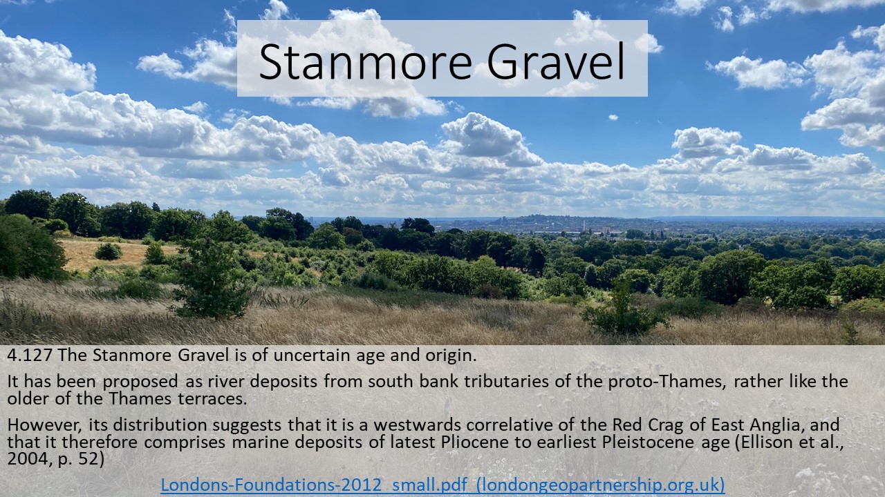
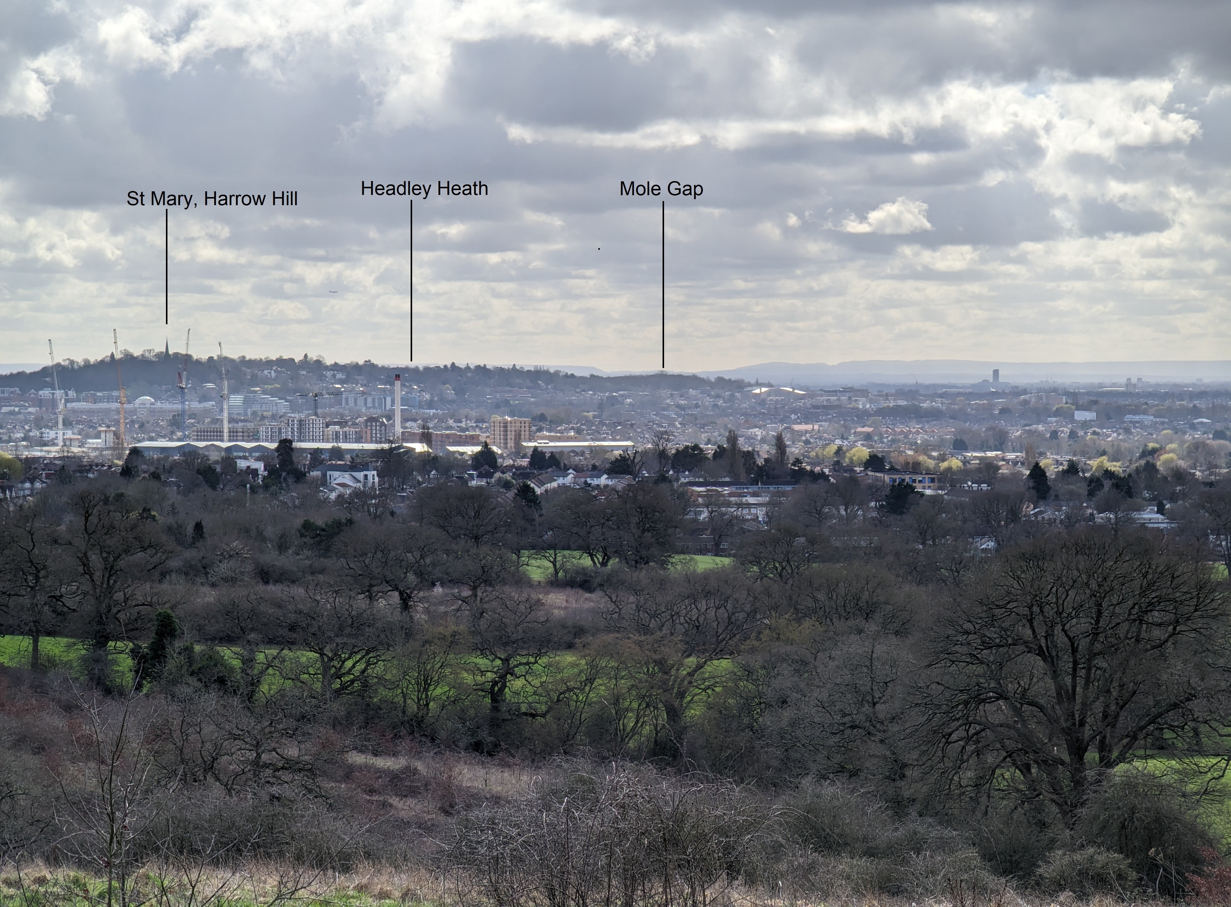
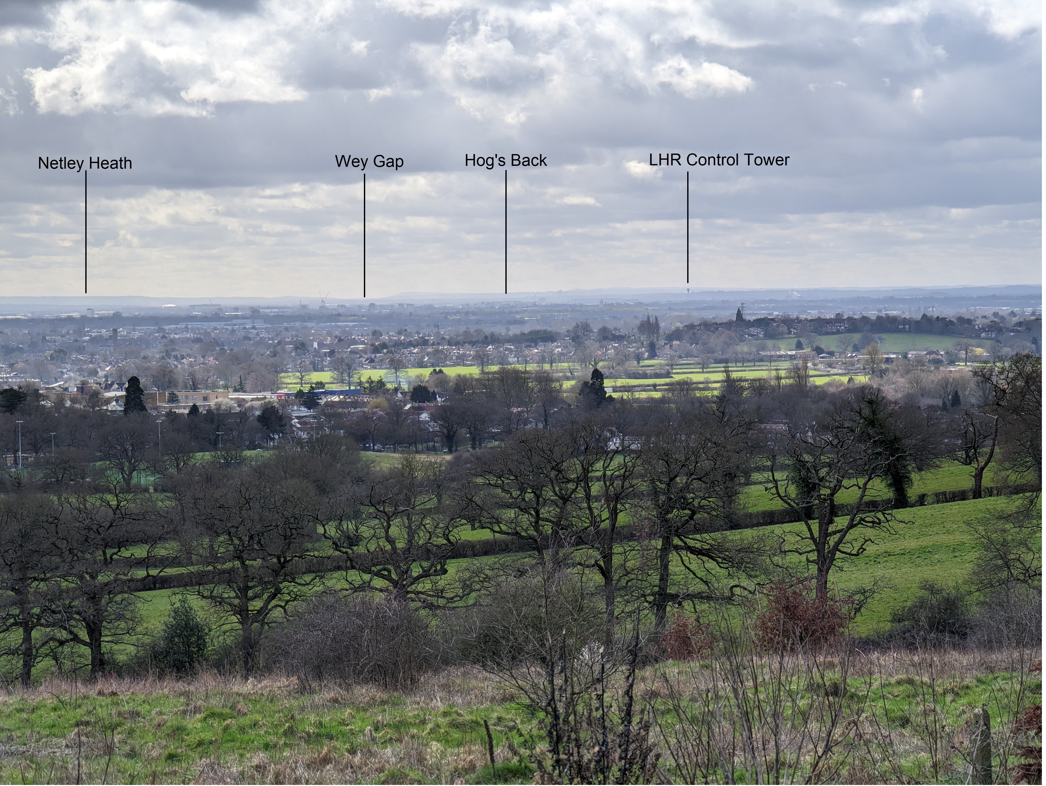
View from Harrow Weald Common looking south across the London Basin to the North Downs
×
|
×
|