Colleen's page Colleen has been travelling the world for some time now. She keeps in regular contact and has not neglected her geology.
Colleen's photos from China (southern Tian Shan)
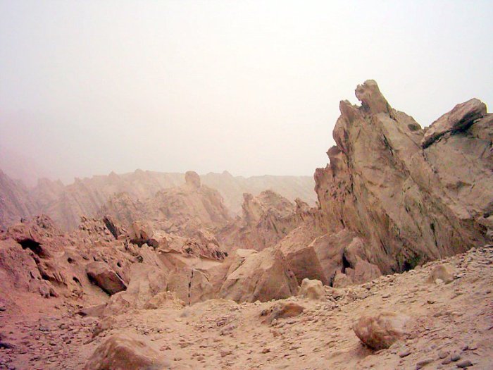
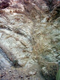
Jagged Rocks in the Southern Tian Shan mountains. Mud & sand eroded, almost vertical strata
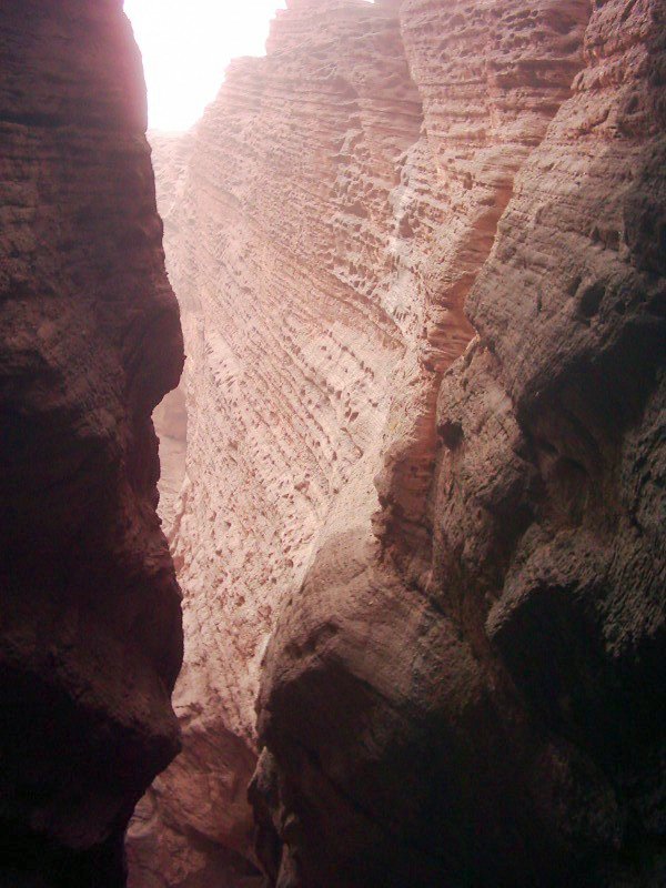
China's Grand Canyon, north of Korla, (southern Tian Shan.) Well worth the visit. Wind & water erosion. Sand, mudstone. In places there are
cemented pebble beds & much folding /faulting. Upstream I walked over beds
of ice, the sun has little chance of penetrating the narrow canyon.
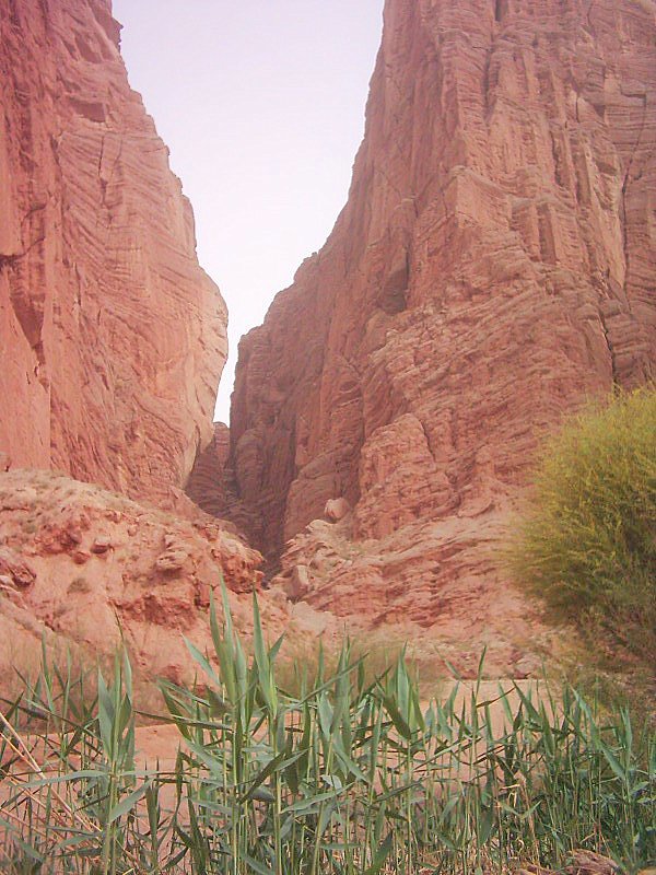
Canyon entrance
Korla, southern Tian Shan mountains, north of Talamakan desert.
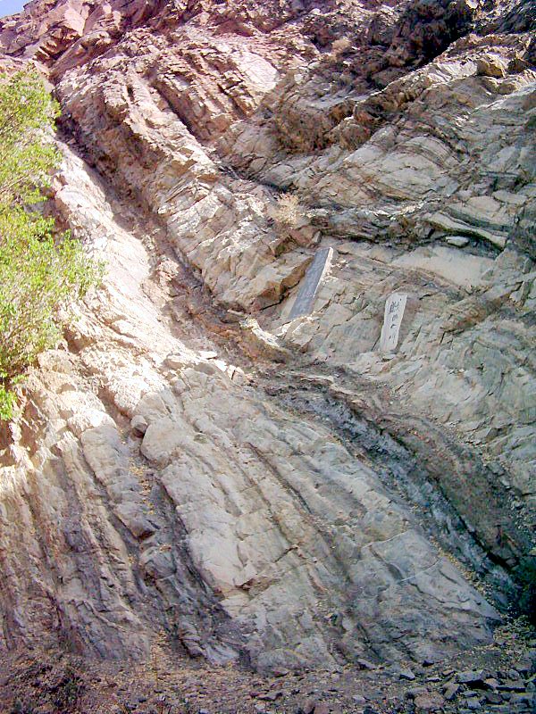
100ma fault on Peacock river. Sandstones, mudstones, quartzites, eroded faultline on upper left to lower right.
Eroded fault from previous picture is on left.
Granite upper right
Colleen's review of Taranaki, New Zealand
The Volcanic History of Taranaki
Mount Taranaki /Egmont and the volcanoes to the north have been built by two million years of volcanic activity that has lasted from the early Pleistocene almost to the present day. Prior to this, Taranaki was covered by a shallow sea, as evidenced by the seashell deposits of Eastern Taranaki, beneath which a sequence of sediments was deposited during the Tertiary. Oil and gas within these sediments gradually flowed upwards into structural traps where they could not escape to the surface; they have been subsequently drilled and commercially developed, e.g., at Kapuni and offshore Maui.
The lavas which have been extruded from the Taranaki volcanoes (Egmont, Pouakai, Kaitake and Paritutu) cover a comparatively small area, mostly at high altitudes. Below the 900m contour they merge into the ring plain. This has been constructed from collapses of pre-existing volcanic cones at each site. These collapses initiated massive debris avalanches to inundate the surrounding lowlands, together with lahars and alluvium.
The outskirts of the Taranaki ring plains are bounded to the west by the coast and to the east by uplifted Tertiary mudstone and sandstone country. Over time, volcanic activity has moved from NNW to SSE in Taranaki, along an apparent major linear fracture in the Earth's crust. From north to south, the Taranaki volcanoes comprise:
• Paritutu Volcano – the spine of Paritutu on the New Plymouth foreshore and the nearby Sugar Loaf Islands, positioned slightly to the northeast of the principal volcanic line.
• Kaitake Volcano, a remnant extinct volcano, about 5km in diameter.
• Pouakai Volcano, a severely eroded and extinct volcano, about 10km in diameter.
• Egmont Volcano,a classic and almost perfect volcanic cone of interbedded lavas and breccias that stretches almost 20km in diameter.
All these cones are composed of andesite lava flows . The Egmont andesite has feldspar and augite or hornblende crystals within a glassy matrix. In the central part of Kaitake volcano are diorites. Besides lava, each of the volcanoes also produced large thicknesses of tephra.